How to Get to the Perdido River Trail: Staple Fork Landing from Red Beard’s Outfitter
Trailhead Directions: From Red Beard’s Outfitter to the Perdido River Trail – Staple Fork Landing
Looking to trade pavement for pine needles and swap city buzz for the calm of the forest? Just under an hour from Red Beard’s Outfitter in Mobile lies one of our favorite hidden gems: the Staple Fork Landing entrance to the Perdido River Trail. Whether you’re headed for a peaceful hike, a trail run, or a place to simply breathe in the quiet, this guide will get you there smoothly.
📍 Starting Point: Red Beard’s Outfitter
Address: 51 Kenneth St, Mobile, AL 36607
We’re located right off Dauphin Street in midtown Mobile. From here, your journey east takes you across the bay and deep into the heart of Baldwin County.
🚗 Step-by-Step Driving Directions
Get on I-10 East
-
Head south on Kenneth Street toward Dauphin Street (0.1 mi)
-
Turn left onto Dauphin Street (1.6 mi)
-
Turn right onto South Broad Street (0.1 mi)
-
Turn left onto Government Street (0.7 mi)
-
Keep left to continue on US-98 E/Government Street (0.7 mi)
-
Slight right, then slight right again to merge onto I-10 E (0.4 mi)
You’ll now be on I-10 East heading out of Mobile.
Travel Across the Bay
-
Stay on I-10 E for approximately 25 miles
-
Take Exit 53 for County Road 64 toward Wilcox Road

Onto the Backroads
-
Turn left onto Co Rd 64/County Rd 64 Extension (7.1 mi)
-
Turn right onto Old Pensacola Road (5.2 mi)

Keep your eyes open as things start getting a little more rural—you’re almost there!
The Final Stretch: Staple Fork Road
-
Turn left onto Staple Fork Road, a dirt road marked with a yellow gate and a sign for Staple Fork Landing


-
Travel 1.3 miles until the road splits
-
Turn right following the Staple Fork Landing sign (0.6 mi)
-


-
You’ll arrive at a small parking area with a kiosk containing trail information and Wildlife Management Area (WMA) regulations

🥾 Trail Access
From the kiosk:
-
Walk downhill along the dirt road about 200 feet
-
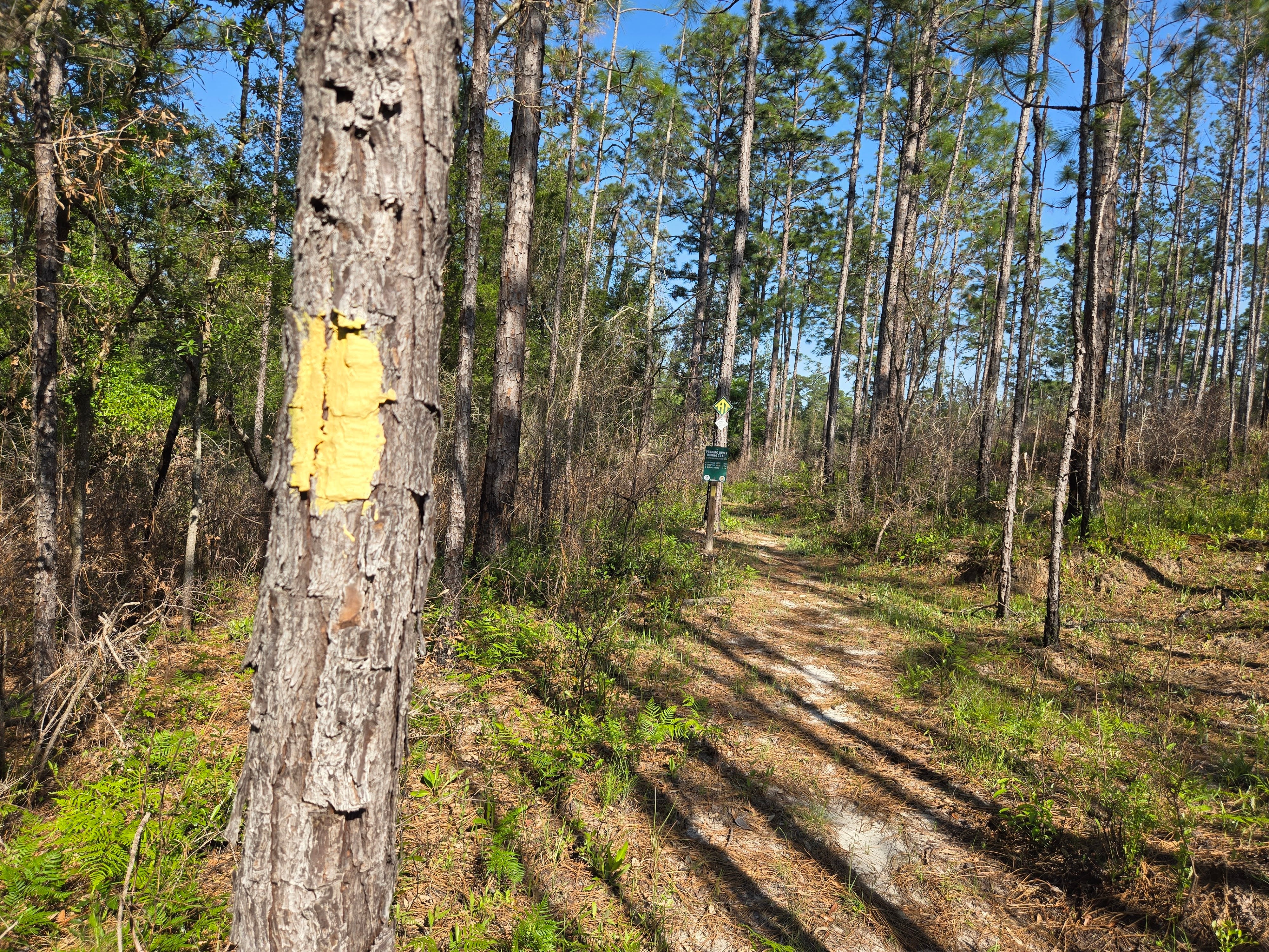
You’ll reach the Perdido River Trail at an intersection marked with yellow tree blazes and small signs


🌲 What to Expect
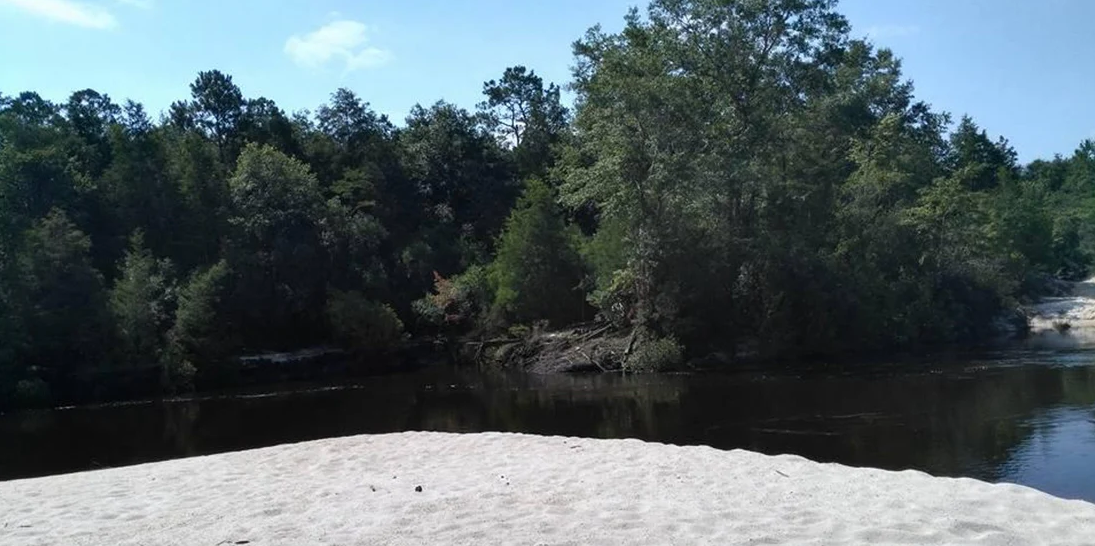
The Perdido River Trail offers a blend of elevated bluffs, shaded pine corridors, and stunning views of the river itself. It’s ideal for a half-day escape or a more extended backcountry experience if you’re prepared.
🚙 Total Travel Time
Approximately 45–50 minutes, depending on traffic
🧭 Pro Tip
This is a remote trailhead—there are no restrooms or stores nearby. Make sure you’ve got:
-
Water
-
Snacks
-
A trail map or GPS
-
Bug spray (you’ll thank us)
We love pointing folks toward great adventures. Have questions about gear, trail conditions, or what to wear? Stop by the shop before you go—our team is always happy to help!
See you on the trail,
—Red Beard’s Outfitter